Upcoming/Recent Meetings
| Date | Group | Topic |


Global Image by MERSI

Image of Latin America by MERSI
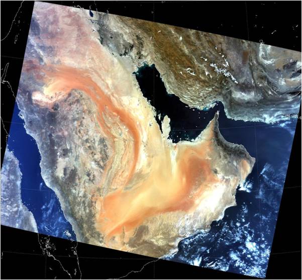
Image of Arabian Peninsula by MERSI

Image of Libya by MERSI
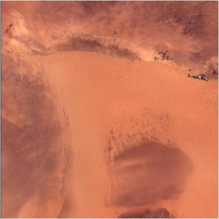
Image of Libya by MERSI
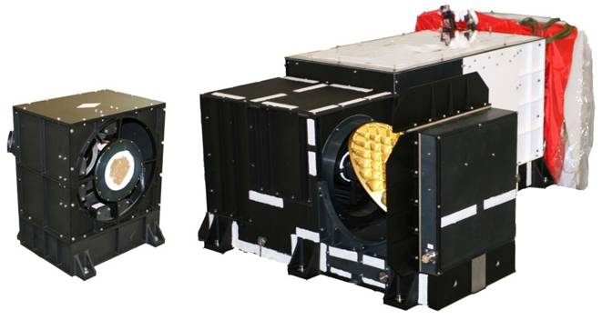
Photo of MERSI Instrument
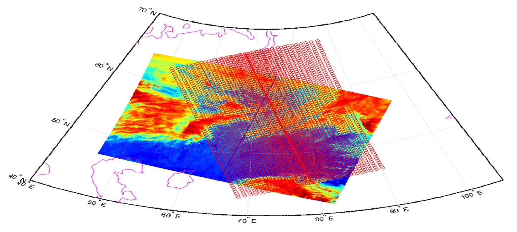
LEO-LEO Collocated Images

GSICS Evaluation of FY3A IRAS
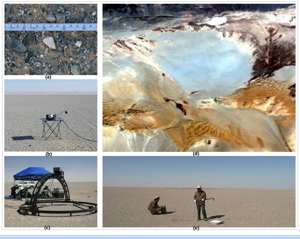
Dunhuang Site
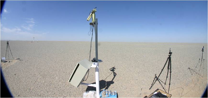
Dunhuang Site
FY Calibration & Validation Introduction
GSICS Processing and Research Center in CMA
GSICS is one of the space components of the World Meteorological Organization (WMO). Its mission is to provide users with high-quality and inter-calibrated measurements from operational satellites. Please see the GSICS central homepage operated by NOAA/NESDIS in the U.S. for more details. National Satellite Meteorological Center (NSMC) under China Meteorological Administration (CMA) contributes to GSICS as a GSICS Processing and Research Center (GPRC) for the Fengyun series Meteorological Satellites inluding Geosationary FY-2X/4X series and polar-orbiting FY-1X/3X series.GSICS Inter-Calibration for FY-2X
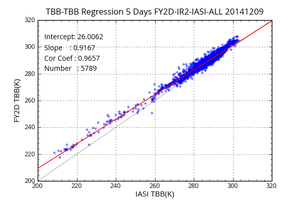
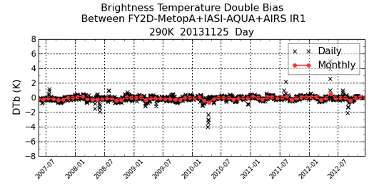
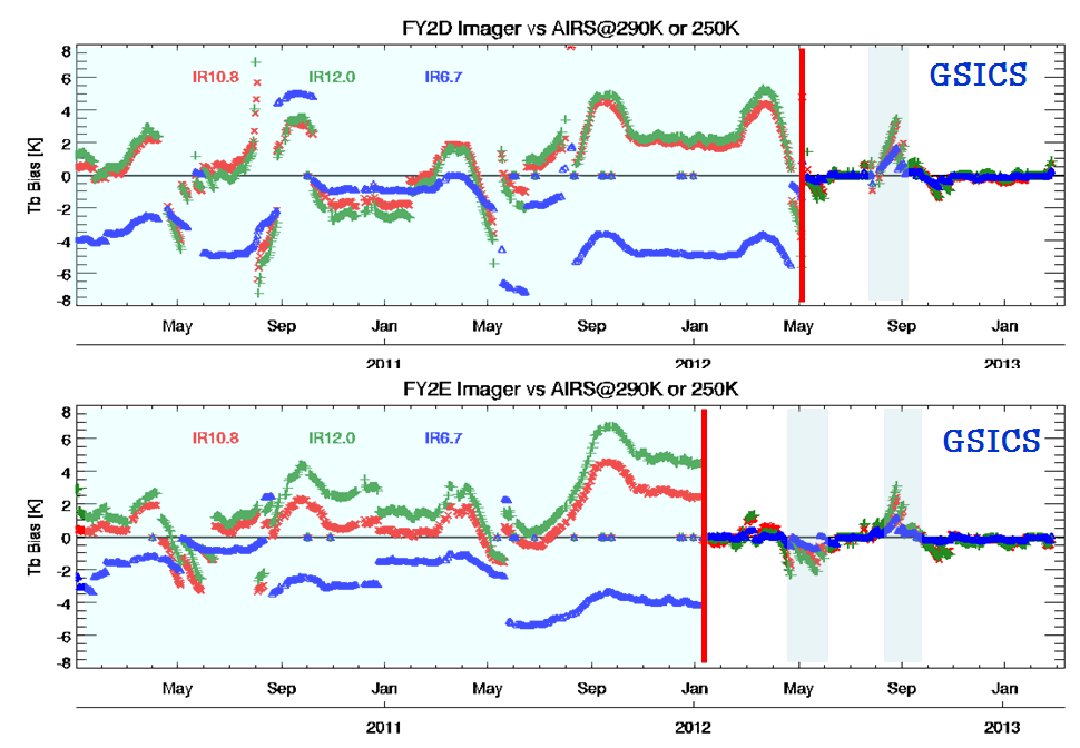
Within the GSICS framework, FY-2X infrared data are operationally compared with those from high-spectral-resolution sounders, such as the AIRS equipment on the AQUA satellite and the IASI instrumentation on the METOP satellite. CMA GSICS Processing and Research Center (GPRC) established GSICS GEO-LEO IR operational routine which adjusted JMA GSICS codes to the interface of the normal FY-2C/2D L1 data and their spectral response function (SRF) files. This operational processing begun in September, 2009 and provides the real-time result on web. JMA spectral compensation method is also used for spectral gap filling of hyper sounders AIRS and IASI (Tahara, 2008; Tahara, 2009). IASI data is ordered and downloaded from NOAA CLASS, AIRS data from NASA GES DISC. GSCIS GEO-LEO IR ATBD of CMA is almost same as JMA (Hiromi, 2009) except for some collocation criteria. The baseline collocation algorithms used in this inter-calibration are determined by the GSICS research working group (Wu, 2008). To compare data between FY-2C/2D and hyper sounders, the information simultaneously observed is first collocated. Then, the radiances observed by hyper sounder channels are accumulated according to the spectral responses of the FY-2C/2D infrared channels to estimate their radiances as well as the spectral compensation.GSICS for FY-3X Optical Instruments
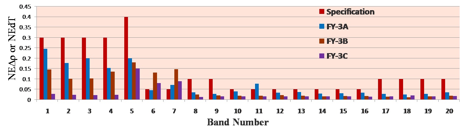
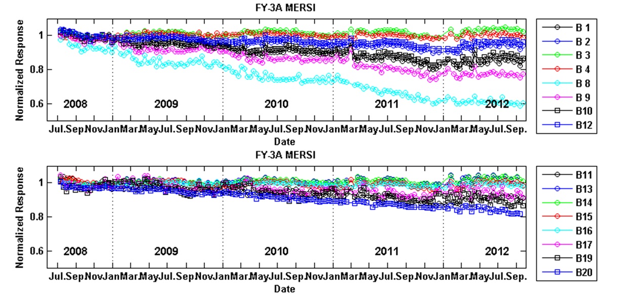
There are three optical instruments (the MEdium Resolution Spectral Imager - MERSI, the Visible and InfraRed Radiometer – VIRR, and the InfraRed Atmospheric Sounder - IRAS) onboard FY-3A. Several calibration methods for these instruments are performed, and instruments performance is being monitored by the Instruments Performance Monitoring (IPM). Various measures are applied to try to improve the calibration accuracy, for instance, using the China Radiometric Calibration Sites (CRCS), inter-calibration based on GSICS SNO method and sites cross-calibration method, calibration degradation monitoring from CEOS/WGCV global reference sites. An integrated calibration system based on above methods is designed and being established in 2009. The FY-3A Data Quality Control System (QCS) is designed for MERSI/VIRR L1 data quality assessment. A calibration data platform has been established including the MERSI/VIRR OBC files (engineering and telemetry data), SNO data of reference sensors used for GSICS inter-calibration and global reference sites image of these three sensors. This is an important database for FY-3A optical instruments radiance-based calibration and validation.